27
Climate Services for Coping with Climate Change, Drought, and
Extreme Heat in the México-U.S. Border Region
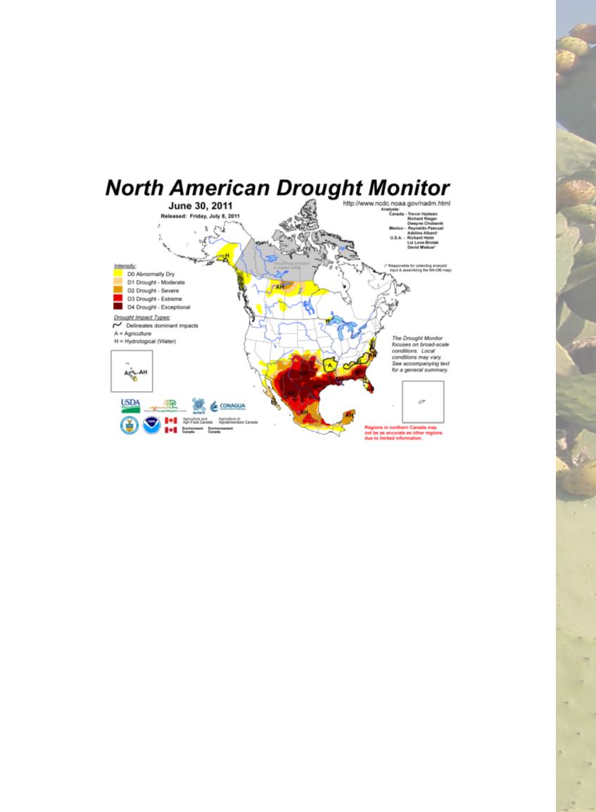
Figure 1. Monitor de Sequia de América del Norte (North American
Drought Monitor) (June 30, 2011). The map illustrates the extent and
severity of drought conditions in the RGB region in 2011.
Source: NOAA, National Centers for Environmental Information. https://
.
notably, impacts to agriculture in the río Conchos Basin—were
sustained across the region (e.g., Shafer
et al.,
, 2014; Hoerling
et al.,
,
2013). The pilot initially focused on four areas: observations and
monitoring, NADM and drought related activities, outlooks and
forecasting, and impacts in the region. Initial partners included
NOAA’s National Climatic Data Center (now called National
Centers for Environmental Information), Servicio Meteorológico
Nacional, Comisión Nacional del Agua (Conagua), the National
Drought Mitigation Center, the Climate Assessment for the
Southwest (CLIMAS / University of Arizona), the Western Regional
Climate Center, the South Central Impacts Planning Program
(SCIPP / University of Oklahoma), and NOAA’s Climate Prediction


