119
Tecnología y Ciencias del Agua
, vol. VIII, núm. 2, marzo-abril de 2017, pp. 117-126
Wang
et al
.,
Simulation for non-point source pollution based on QUAL2E in the Jinghe River, Shaanxi Province, China
ISSN 2007-2422
•
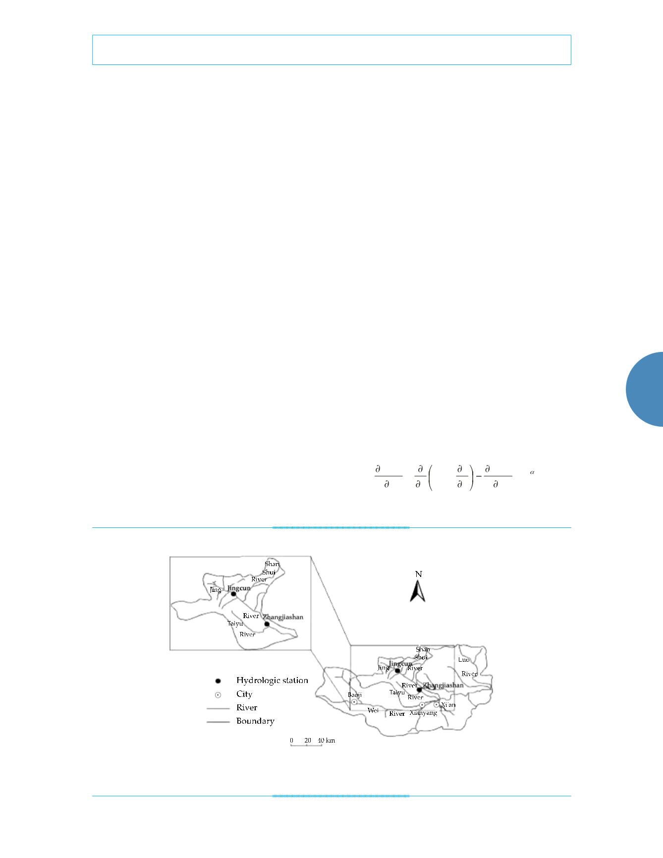
Shaanxi Province in Tangqu in Changwu Coun-
ty and merges with the Weihe River in Chenji-
atan Village, Gaoling County. The Jinghe River
is about 272.5 km long and it drains an area of
9 210 km
2
in Shaanxi Province (figure 1). In the
Zhangjiashan section, the Jinghe Basin is mainly
composed of a loess plateau and hilly gullies.
The loess plateau region has a flat surface and
is the agricultural center of the area, while the
hilly-gully one is subjected to significant soil
erosion promoted by high runoff rates and the
relatively poor vegetation coverage. There are
also small areas of stony soil and mountain for-
est in the Jinghe Basin. The area downstream
from Zhangjiashan is dominated by river ter-
races. The average precipitation is 556 mm,
but there is significant inter- and intra-annual
variations in precipitation. Precipitation in the
four months from July to October accounts for
56% of the annual precipitation. The industry is
yet underdeveloped in this agricultural region,
which is the main grain and cotton producer
of Shaanxi province. However, in recent years,
water quality has been steadily deteriorating
in Shaanxi province because of the on-going
industrial and agricultural developments.
Figure 1. Jinghe River basin, Shaanxi province, China.
River water quality model
Three main processes occur when pollutants en-
ter a river, namely, flow migration, random dif-
fusion at pollutant points, and transformation of
pollutants (Beck, 1987). It is very difficult to find
a solution for a non-steady multidimensional
model, and furthermore, the analytical formula
is very complex. However, recent studies have
shown that one-dimensional steady models
can solve the actual problems in many rivers.
We used QUAL2E, the updated and improved
version of the QUAL-Ⅰ and Ⅱ developed by the
USEPA in the 1970s, for the simulation. It is
based on the stream dispersion mass transfer
equation that describes spatial and temporal
changes in any water quality variable. In this
equation, the source and sink caused by chemi-
cal, physical, and biological effects (including
the impacts of the branch and discharge outlet)
are included along with terms to describe flow
migration and dispersion (Reckhow, 1999), as
follows:
S x
Qc
x
cADx t
Ac
x
±
=
) (
) (
(1)


